Sunday, 1 November 2015

Prambanan Temple

Prambanan Temple


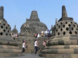
Candi Prambanan or Loro Jonggrang is the largest Hindu temple complex in Indonesia, which was built in the 9th century BC. This temple is dedicated to Trimurti, the three main Hindu gods Brahma as the creator god, Vishnu as the preserver god, and Shiva as a god of destruction. Based on the inscriptions Siwagrha original name of this temple complex is Siwagrha (Sanskrit which means 'house of Shiva'), and indeed in garbagriha (main hall) of the temple sits a statue of Shiva Mahadeva three meters high which shows that in this temple of Lord Shiva are preferred.

The temple complex is located in the district of Prambanan, Sleman and sub Prambanan, Klaten, approximately 17 kilometers northeast of Yogyakarta, 50 kilometers southwest of Surakarta and 120 kilometers south of Semarang, exactly on the border between the provinces of Central Java and Yogyakarta.  It is very unique, Prambanan temple is located in the administrative area Bokoharjo village, Prambanan, Sleman, while the entrance to the Prambanan temple complex located in the village administration Tlogo, Prambanan, Klaten.

This temple is including the UNESCO World Heritage Site, the largest Hindu temple in Indonesia, and one of the most beautiful temples in Southeast Asia. The architecture is shaped tall and slender according to Hindu architecture in general with the Shiva temple as the main temple has a height reached 47 meters towering in the center of the complex cluster of temples are smaller. As one of the temples of the grandest in Southeast Asia, Prambanan temple the main attraction of tourists visiting from all over the world.

According to the inscription Siwagrha, this temple was built in about 850 BC by Rakai Pikatan, and continue to be developed and expanded by Balitung Maha Sambu, during Medang Mataram kingdom.


Temple Complex

The entrance to the building complex is located in the four corners of the wind direction, but the direction toward the building is to the east, the main entrance of this temple is the east gate. Prambanan temple complex consists of:


  1. 3 Trimurti temple: the temple of Shiva, Vishnu, and Brahma
  2. 3 Wahana temple: temple Nandi, Garuda, and Geese
  3. 2 Temple Apit: located between rows of Trimurti temples and temples rides in the north and south
  4. 4 Temple Kelir: located in the 4 direction right behind the entrance to the inner courtyard or the core zone
  5. 4 Temple Stakes: located at the 4 corners of the pages or the core zone
224 ancillary temples: 4 rows are arranged in concentric with the number of temples from the innermost to the outermost rows: 44, 52, 60, and 68


Then there are a total of 240 temples in the complex of Prambanan.

Originally there were 240 large and small temples at Prambanan temple complex. [13] But now only 18 temples; ie 8 main temples and 8 small temples in the core zone and 2 ancillary temples. Many ancillary temples have not been restored, of 224 perwara only 2 that have been restored, leaving only a pile of stones scattered about. Prambanan temple complex consists of three zones; The first is the outer zone, the second is the middle zone consisting of hundreds of temples, the third is in a zone which is the zone of the main temple is the holiest place eight and eight small temples.

Prambanan temple complex cross-section of the plan is based on a square yan land consists of three sections or zones, each zone is bordered pages andesite stone wall. The outer zone is marked with a square fence on each side along the 390 meters, with the orientation of the Northeast - Southwest. Unless the remaining southern gate, part of another gate and walls of the temple are many missing. The function of the outer courtyard is not known; the possibility of park land is sacred, or dormitory complex Brahmin and his students. Perhaps first building standing in the outer courtyard is made of wood, so it had rotted and destroyed nothing left.

Prambanan is one of the largest Hindu temples in Southeast Asia apart from Angkor Wat. The three main temples called Trinity and dedicated kepadantiga main god Trimurti: Shiva the Destroyer, Vishnu the Preserver and Brahma the Creator. Shiva in this temple complex are preferred and more exalted than the other two gods Trimurti. Shiva temple as well as the main building of the largest and highest, 47 meters tall.

Ijen Mountain

Ijen Mountain


Ijen mountain is an active volcano located on the border between Banyuwangi and Bondowoso, East Java, Indonesia. This mountain has an altitude of 2,443 m and has several times erupted. The last eruption occurred in 1999. One of the most famous natural phenomenon of Mount Ijen crater is located at the peak. To climb this mountain to be departing from Banyuwangi or from Bondowoso.

Kawah Ijen


Kawah Ijen is an acidic crater lake located on top of Mount Ijen with 2,443 meters high above sea level to a depth of 200 meters and a vast lake crater reached 5,466 hectares. Ijen crater lake known as a highly acidic lake water world. Ijen crater is within the Park Reserve Travel Ijen, Banyuwangi, East Java. Every morning at around 02.00 until 04:00, around the crater can be found the phenomenon of blue or blue flame of fire, which is the uniqueness of this place, because the natural scenery of this only occurs in two places in the world, Iceland and Ijen. From the crater, we can see another mountain scenery in the complex Ijen Mountains, among which is the peak of Mount Merapi, which is located in the east of the crater, Mount roar, Mount Suket, Mountain Chain, and so on.

image : Blue fire kawah ijen
Ijen crater blue fire is a natural phenomenon that is in the crater of Ijen.

Event at Kawah Ijen

Many events are often held, mainly by the Government of Banyuwangi are now in full swing to promote the crater in the list of tourist objects. Events that include: Tour de Ijen (now renamed 'International Tour de Ijen'), Jazz Ijen Banyuwangi, etc.


The sulfur miners in Mount Ijen Crater Tourism


Mount Ijen crater known besides their stunning natural beauty, also known as sulfur mine every day by people around taken and used as a source of income. Thus making the tourists alternated come to enjoy the beauty of the formations in the crater of Ijen mountain that lies between Bondowoso and Banyuwangi. Travel Ijen crater is already known by the public at large in Indonesia to around the world. One concern over rating is the traditional sulfur miners still better than digging up the way carriage way.

Ijen crater on the mountain there is a very big source of sulfur that came out of the pit crater Ijen crater. The miners at the crater of Ijen, they have a high mental and embroidery. Although they have to enter the area bursts of smoke very bad for his health, they never complained or despair. In addition, the equipment they use is also very far from the advanced equipment. After that, they must be transported by means of the colonies bear the crater up to About a storage area within 4 km.

Travel Ijen Crater as sulfur miners Livelihood

Equipment they use can be categorized as traditional equipment, they only use iron bars to break the sulfur that has been hardened, then they haul by using a basket made of bamboo can be a heavy load reaches 70 to 80 Klo Klo. One day they could have done twice, from the post where they are willing to do the weighing back and forth to get purse purse rupiah.
Pera miners sulfur in Ijen crater, also can become enthusiastic for the tourists who are visiting in the crater of Ijen. In because they seemed to do the attractions in an open space by using a strong balance. Where they have to bear a very heavy burden to set foot on the path that the towering. That's the life of the activity undertaken by people on the slopes of the crater of Ijen.

Borobudur Temple

Borobudur Temple


Borobudur is a Buddhist temple located in Borobudur, Magelang, Central Java, Indonesia. The location of the temple is approximately 100 km southwest of Semarang, 86 km to the west of Surakarta, and 40 km northwest of Yogyakarta. Stupa-shaped temple was founded by the Mahayana Buddhists around the year 800 AD during the reign of the Sailendra dynasty. Borobudur is the largest Buddhist temple or shrine in the world, and one of the largest Buddhist monument in the world.

This temple is composed of six terraces square on which there are three courtyards circular, the walls are decorated with 2,672 relief panels and originally there were 504 statues of Buddha. Borobudur has a collection of reliefs of Buddha most complete in the world. The main stupa biggest teletak in the middle once crowned this building, surrounded by three rows of circular 72 perforated stupas in which there are statues of buddha sitting cross-legged in the lotus position perfectly with mudra (hand gesture) Dharmachakra mudra (turning the wheel of dharma).

According to historical evidence, Borobudur was abandoned in the 14th century as the weakening of the influence of Hindu and Buddhist kingdoms in Java as well as begin the influence of Islam. The world began to realize the existence of this building since it was discovered in 1814 by Sir Thomas Stamford Raffles, who was then serving as the British Governor General of Java. Since then Borobudur has suffered a series of rescue and restoration efforts. The restoration project was held in the period 1975 to 1982 for the efforts of the Government of the Republic of Indonesia and UNESCO, then this historic site included in the list of World Heritage Sites.


The Origin of the Discovery of Borobudur Temple

After Borobudur was completed, some of the inscriptions mention if the temple is then used by the time the Buddhist religion as a place of worship and pilgrimage. Use of this temple lasted only a short time, which is about 150 years old. In short the use of this temple is not in accordance with the long process of development. It is known to occur because of the massive migration of people around the Buddhist temple because of the collapse of the Sailendra dynasty. They pressured by the existence of the Hindu in quantity it more.

By getting at least the Buddhists around the region (Magelang today), Borobudur then not used again. He was not maintained and partially destroyed by people who do not think the importance of heritage in the future. Because no longer neglected, Borobudur was then further damaged by nature. Abandonment of a long time to make this magnificent temple overgrown with large trees, buried by volcanic ash in the surrounding areas, and covered the missing buried in the ground. [READ: Batu Merah Delima, usefulness, origin and price]


The restoration of Borobudur Temple First

Although already cleared from all sorts of debris, soil, and big timber cover. Borobudur temple is not yet perfectly shaped. Many parts gompel, lost and damaged by age swallowed. Recognizing this, in the year 1907-1911 AD, under the leadership of Van Erf, the Netherlands began a restoration of the temple, which seem rudimentary. This restoration was done with conventional technology, so that the relief has not been well established as the original. Borobudur restoration is only done merely to avoid further damage by moving rocks are vulnerable to collapse of origin Borobudur initially neglected. Nevertheless, Erf already contributed to the Indonesian people because he has saved the relics of the ancestors of Indonesia it from further damage.


Borobudur Restoration Stage Next

Preoccupied by political forces, military, economic, since the course of the first world war, some of the governments that had ruled Indonesia from the Dutch Colonial government, the Japanese Colonial Government, and the Government of Indonesia is no longer concerned with the heritage value of this history. Borobudur left without care, neglected and disregarded

Over time, when the country's condition began to improve, on August 10, 1973 further restoration was then conducted in the leadership of President Soeharto. Evidence of this restoration in the form of inscriptions weighing 20 tons were deliberately created and placed in the Northwest Temple facing east. Uniquely, the restoration of Borobudur temple which is under the leadership of Dr. Soekmono was carried out by about 600 workers most of whom are young workers high school graduates and STM building that previously have been given education and skills, especially on the field of Archaeology Chemika (CA) and Technology Archaeology (TA). They are the native sons and daughters of the Indonesian people themselves, none of which experts from abroad.

Some parts were restored from Borobudur Temple at that time, among others Rapadhatu (spot rate at the bottom of a square), the foot of the temple, Terrace 1, Terrace 2, Terrace 3, and Stupa Parent. With so many parts that have been restored, the time required for the course of the work is about 10 years. Yes, restoration was completed on February 23, 1983.

Borobudur Current

Borobudur is currently annually visited by more than 3.5 million tourists both local and foreign (Data in 2013). Regarding the origin of Borobudur, in one part of the temple is also described briefly. You can enjoy the beauty that is presented from the historic building, where the mountains that surround the Sailendra dynasty heritage building is certainly making its own experience. Wait no more, immediately got up to go to Magelang, and see one of the wonders of the world in Indonesia this.


Saturday, 31 October 2015

Raja Ampat

Raja Ampat


Raja Ampat is a series of four adjacent islands located in the western part of the Bird's Head (Vogelkoop) Papua Island. Administratively, this cluster are under Raja Ampat, West Papua province. The islands are now a destination for divers who are interested in the beauty of the underwater scenery. The four islands that are members named by the four biggest islands, namely Pulau Waigeo, Misool Island, salawati and Batanta Island.
image : Raja Ampat


Raja Ampat community

Raja Ampat Islands society generally traditional fishermen who live in small villages are located far apart and different islands. They are friendly people who receive visitors from outside, especially if we bring a souvenir for them in the form of nut or candy. This item becomes a sort of 'peace pipe indian' in Raja Ampat. The event chatting with eating nut called "Para-para Pinang" often take turns throwing each other mob, the local term for funny stories.

They are Muslims and Christians, and often within a family or clan are members embraced one of the two religions. It makes the people of Raja Ampat remain in harmony despite different beliefs.
image : Fisherman


Wealth of natural resources

Raja Ampat Islands is a place that has the potential to serve as a tourist attraction, especially tourist dives. Raja Ampat Islands waters according to various sources, is one of the 10 best waters for diving sites around the world. In fact, it may also be recognized as number one for the completeness of underwater flora and fauna at the moment.

Dr. John Veron, coral experienced experts from Australia, for example, in a site it is revealed, the Raja Ampat Islands located at the westernmost tip of the island of Papua, about 50 miles northwest of Sorong, has the best coral regions in Indonesia. About 450 species of coral had been identified during the two weeks of research in that area.

image : Coral reefs


Access

Visiting these islands is not too difficult if it takes time and considerable cost. We can use the airline from Jakarta or Bali to Sorong via Makassar and Ambon and Manado for approximately 6 hours of flight. From Sorong, a fairly large city with quite complete facilities. To explore the Raja Ampat there are two choices, take a tour by boat Phinisi or stay at the resort Raja Ampat Dive Lodge. Even though most of the tourists who come to Raja Ampat is currently the divers, in fact the location is attractive also for non tourist divers because it also has sandy beaches and white is very beautiful, a cluster of islands karst nan stunning and flora and fauna unique endemic like paradise red, bird of paradise Wilson, maleo Waigeo, various parrots and parrot, possum Waigeo, as well as various types of orchids.


Conservation

To preserve the underwater Raja Ampat Islands, conservation efforts are needed in this area. There are two international organizations that concern about the preservation of natural resources Raja Ampat, namely CI (Conservation International) and TNC (The Nature Conservancy). The Government has set itself the seas around South Waigeo, which includes the small islands such as Gam, Mansuar, groups and group Yeben Trunk Pele, has been approved as a Marine Sanctuary. According to the Minister of Forestry Decree No. 81 / KptsII / 1993, the total area is 60,000 hectares.

In addition, some other marine areas have been proposed to be a conservation area. Each is a Marine Sanctuary South Misool Island, Sea Island Kofiau, sea Asian Island, Sea Island and Sea Island Honey Ayau.


Culture

Raja Ampat as part of the province of West Papua on the island of Papua, rich variety of cultural arts of music, dance and crafts typical of Papua are very exotic. Each tribe scattered in the Raja Ampat islands generally have a dance and procedures of their own customs. The general characteristics of the dance and music of Raja Ampat is a dance movement that is generally displayed with a vibrant and accompanied by percussion instruments typical of Papua named Tifa, gong (mambokon) and drums (bakulu). Besides percussion instruments, stringed instruments such as guitars and wind instruments such as flutes and wind instruments from sea shells are also often used to accompany the dance. Some examples of dances that are often featured in various ceremonies and reception is dance Wor, Main Moun, Batpo Dance, Dance Yako and art Flute drums.
image : People play tifa 


image : people play mambokon

Female dancer costumes used in various typical dances Raja Ampat typically use a blend of bright colors with high contrast such as red, amber, green light and blue light. As for the costumes male dancer generally is shirtless at the top and to cover the waist down normally using costumes typical of Papua who mediami pesisisr beach is clothing of material fiber (fibers), woven coconut leaves or feathers and animal skins depending on the type of dance sung. There are also men who appeared to use cover nakedness that is typical of Papua koteka.Baik male and female dancers will perform complete with accessories and makeup distinctive and exotic that can only be encountered in the traditional art of the island of Papua.

Haven For Animal Rare

Raja Ampat archipelago's natural wealth is not only in water but also on land. Character land where there are no mountains or the mountains that exceed an altitude of 1000 meters, making Raja Ampat forest on land classified as lowland forest. Diversity of wildlife that live in the forests rich at all kind. Preservation of diverse wildlife habitat is protected within the nature reserve. There are 4 nature reserves that exist in the district of Raja Ampat, namely:
1. West Waigeo Island Nature Reserve
2. Western Batanta Island Nature Reserve
3. Preserve North salawati
4. South Misool Island Nature Reserve

Based on the research that has been conducted in the nature reserve area Waigeo West, recorded more than 171 species of birds and 27 species of mammals including bandikut (Echymipera kalubu), kus-kus spotted (Phalanger maculatus), opossums striped (Dactylopsila trivirgata), kalelawar, and the tree shrew Discovered. While the survey in the region of South Misool Nature reserve life of 159 recorded bird species including four species of birds of paradise and 5 species of bats.
In addition, the forests of Raja Ampat is also a haven for many types of rare birds protected conservation. Among these are the parrot white crested (Cacatua galerita), king prawn forest (Halcyon macleayii), julang irian (Aceros plicatus), palm cockatoo (Probosciger aterrimus), parrots (Eclectus roratus), parrot red black head (Lorius lory), viktoria crowned pigeon (Goura victoria), cassowary, bird of paradise (Paradisaea sp.), and maleo (Magrocephalus maleo). (Source: Variety Charm Tourism Raja Ampat, West Papua, 2009).


From various locations over the location Yenwaupnor, Sawinggrai, Yenbeser and Gam Island is relatively easily accessible location to watch the wildlife, especially birds habitat. If you are lucky, you will be able to see for themselves the beauty of the birds that were playing on the white sandy beach or flying and twittering in the trees around you.
The wealth of biological diversity that is stunning both underwater and on land makes the Raja Ampat Islands as a haven of ecotourism activities, both underwater tourism activities and tourism activities on land. Raja Ampat has all its beauty.


Mount Bromo


Bromo

                                         image : Mount Bromo
Mount Bromo ( from Sanskrit : Brahma , one of the main gods in Hinduism ) , is an active volcano in East Java , Indonesia . This mountain has an altitude of 2,329 meters above sea level and located in four districts , namely Probolinggo , Pasuruan , Lumajang and Malang. Mount Bromo is famous as a major tourist attraction in East Java . As a tourist attraction , Bromo become attractive because of its status as the volcano is still active . Mount Bromo is included in the area of ​​Bromo Tengger Semeru National Park .

Mount Bromo shape mesh between valleys and canyons with the caldera or the ocean of sand covering approximately 10 square kilometers .

Mount Bromo has a crater with a diameter of ± 800 meters ( north-south ) and ± 600 meters ( east-west ) . While the danger area of a circle with a radius of 4 km from the center of the crater of Bromo .


                                           image : Mount Bromo Sunrise

Sacred Mountain
 For residents around Mount Bromo , Tengger , Mount Bromo / Mount Brahma is believed to be a sacred mountain . Once a year the Tengger community held a ceremony Yadnya Kasada or Kasodo . This ceremony took place in a temple that is under the foot of Mount Bromo and proceed to the top of Bromo . The ceremony was held at midnight to early morning every full moon around 14 or 15 in Kasodo ( tenth ) according to the Javanese calendar .
                                         Image : Yadnya Kasada/Kasodo Ceremony

Historical eruptions

Mount Bromo has erupted several times , at regular intervals , ie 30 years . The largest eruption occurred in 1974 , while the last eruption occurred in 2011 .